
Dawesfield
- Yen Ho
- May 12, 2022
- 5 min read

Updated: Feb 17, 2024
Last time I discussed about the origins of the street names Lewis Lane and Morris Road and the owners of Dawesfield.
In this post, I'll discuss more about the home: who was the earliest owner of Dawesfield, what role did this home play during the American Revolution with George Washington living in the home, what were some changes/alterations to the home, etc.
The Origins of Dawesfield
Abraham Dawes arrived in the New World with his brothers in the early 1700s. In 1713, Abraham purchased 250 acres of land in Philadelphia, then 419 acres in Whitpain in 1728.
The Dawesfield home was built in 1736. It was unknown who built the Dawesfield home. It could be that Abraham, I set the foundation of the home and allowed his son, Abraham, II, to finish the construction when he came into possession of the property. In 1752, Abraham, II became Justice of the Peace of Whitpain.
Fun Fact #1: The property was known as "Dawesfield" from 1728-1736. When Abraham, II died, the Dawesfield name died out too.

Encampment at Camp Morris:
October 20th-November 2nd, 1777
Abraham, II turned his home over to his son in-law James Morris (1753-1795), who married his daughter Elizabeth Dawes, after feeling ill and moved to Philadelphia. James was a delegate to the Pennsylvania Convention of 1787 to ratify the Federal Constitution. He was also involved in Montgomery County after the county was formed in 1784: he was Justice of the Peace, judge of the Common Pleas Court, Recorder of Deeds and Registrar of Wills, and captain of the Montgomery Troop of Light Horse.
Brigade General George Weedon and his regiment of Virginia troops encamped at James Morris's home
George Washington slept on the second floor of the former West Wing. Marquis de Lafayette slept right below Washington on the ground floor due to his wounded knee from the Battle of Brandywine
During rainy weather, soldiers sought shelter in the barns of the area. There were soldiers who died from the exposure
October 29, North Wing- Council of War was held about the decision to attack the British in Philadelphia
October 30, North Wing- a court-martial was held against Brigadier General Anthony Wayne for his negligence that caused the defeat at Battle of Paoli


Other commanders who were at Dawesfield during the court martial were Nathanial Greene, John Sullivan, Adam Stephen, Alexander McDougall, William Maxwell, Henry Knox, James Mitchell Varnum, Peter Muhlenberg, Jedediah Huntington, Thomas Conway, and Casimir Pulaski.
Fun Fact #2: James and Elizabeth's daughter Hannah told her daughter Phoebe how she remembered sitting on George Washington's lap and being kissed by him when she was a little girl.
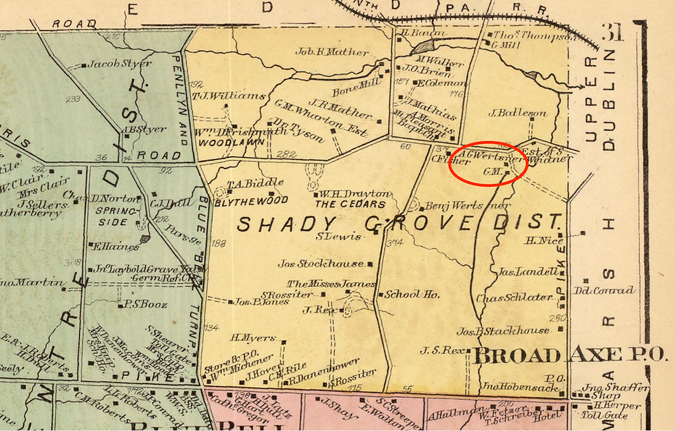
Despite George Washington staying at Dawesfield, residents of Whitpain began to complain about the encampment, causing them distress. There were complaints that soldiers cut down nearby trees to build shelter or other uses. The trees that were cut down were used by James Morris to build his mill near Morris Road, later known as the Werstner Mill.
The Dawesfield Ownership Continues
Hannah Morris (1765-1842) came into possession of the Dawesfield home after her parents past away. She was the wife of Dr. Thomas Chalkley James, the first professor of midwifery at the University of Pennsylvania. It was Dr. James who built the "Westside" home right next to the Dawesfield property. There were difficulties with finance when it comes to Dawesfield. When Dr. James died, he left everything for Hannah with the advise to "dispose of Dawesfield." They had to sell the estate.
Their daughters Rebecca and Phoebe James (1818-1902) moved from Philadelphia to live at Dawesfield in the summer of 1842. It was agreed that Phoebe and her husband Saunders Lewis (1812-1893) would own Dawesfield. They used the estate as a summer home.
The summer home was continually used by their daughter Elizabeth "Bessie" Lewis (1849-1931) and her husband Colonel George G. Meade, Jr., son of Major General George G. Meade, Sr..
The ownership of Dawesfield continued within the family until the second half of the 20th century. It is owned privately today by a local resident.


Architecture
Based on the physicality of the home, it maintained its colonial-style look with additions and alterations. For example, the physical facade of the home is symmetrical with double-hung sash windows on both sides, stone accents over the door entires, pedimented and shed dormers.
Below you can see a timeline of when these additions and alterations were made around the home.
1736- Dawesfield was originally 36 feet across the front and 22 feet deep
1745- a stone addition was made, extending the east side by 22 feet; Pent roof was added; a one-story stone ell was built on the north side, turning the home from rectangular into the L-shape plan
1785- second floor of the ell was added
1786- a stone garden house was built
1795- Large stone barn was built by James Morris
1821- South Wing was added, giving it a T-shape plan
1845- 2 1/2 story stone tenant house was built by Saunders Lewis
1856- the old springhouse was remodeled
1859- one-story wood kitchen extension
1870- Kitchen was expanded to 2 stories; one-story building was added on the north elevation
1884- 2 1/2 story cottage was built
1937- the stone wagon shed was added on the west side of the stone barn
1952- the old ice house was converted into a greenhouse
Bibliography
"Abraham Dawes (1704 - 1776)." Ancestry. Accessed September 30, 2021. https://www.ancestry.com/genealogy/records/abraham-dawes-24-1gb28s.
"Abraham Dawes Sr." FamilySearch. Accessed September 30, 2021. https://ancestors.familysearch.org/en/L52B-4RR/abraham-dawes-sr-1675-1730.
"Ambler Happening: Dawesfield." Montco Happening. Last modified June 1st, 2016. https://montco.happeningmag.com/ambler-happening/.
Bean, Theodore Weber. History of Montgomery County, Pennsylvania, Volume 2. (Philadelphia: Everts & Peck, 1884): 1163-1164.
"Find A Grave." Find A Grave. Accessed September 30, 2021. https://www.findagrave.com.
Glass, Dr. Brent D. National Register of Historic Places Nomination: Dawesfield, Montgomery County, Pennsylvania. Ambler, PA: Whitpain Township. No. 1024-0018.
"Google Maps Area Calculator Tool." DaftLogic. Accessed August 19, 2021. https://www.daftlogic.com/projects-google-maps-area-calculator-tool.htm.
Historic American Buildings Survey, Creator. Dawesfield, House, 585 Lewis Lane, Blue Bell, Montgomery County, PA. Pennsylvania Whitpain Montgomery County Blue Bell Montgomery, 1933. Documentation Compiled After. Photograph. https://www.loc.gov/item/pa3020/.
Lewis, Dr. Morris J. Washington's Headquarters at James Morris' House, in Whitpain in Historical Sketches: A Collection of Papers Prepared for the Historical Society of Montgomery County, Pennsylvania, Volume 2. (Norristown: Historical Society of Montgomery County, Pennsylvania, 1900): 196-200.
"Local History. The Dawes Plantation, Whitpain--James Morris--The Morris Will--The Lewis Country Seat." Ambler Gazette. March 28, 1901. http://digitalcollections.powerlibrary.org/cdm/compoundobject/collection/wivp-gazett/id/2009/rec/1.
Morris, William E. Map of Montgomery County, Pennsylvania : from original surveys. 1849.
Mueller, A. H. Atlas of the North Penn Section of Montgomery County, Pa., Plate 28, 1916.
"Revolutionary Associations. Washington and Lafayette in the Old Lewis House." Ambler Gazette. November 7, 1911. Page 7. http://digitalcollections.powerlibrary.org/cdm/compoundobject/collection/wivp-gazett/id/4008/rec/4.
Whitpain... Crossroads in Time. (Montgomery County, PA: Whitpain Township Bicentennial Commission, 1977): 152-165.


Comments