
The Railroads and Stations of the Wissahickon Valley Region
- Yen Ho
- Oct 27, 2022
- 5 min read

I began commuting on SEPTA Regional Rails since I was 13 years old. Later on I began taking the train on my own ever since my first day at Temple as an undergraduate. Since 2015, I never thought about how these railways and stations came about.
History of the North Pennsylvania Railroad
"A city should strive to be paramount in influence and attraction within a circle whose circumference it should be her aim to enlarge, and equal in all respects with her competitors and rivals, throughout portions of the vast territory spreading outside and beyond their local bounds."
- Office of the NPRC, October 3rd, 1853

Before the company was named the North Pennsylvania Railroad, it was named as Philadelphia, Easton and Water Gap Railroad Company. It was formed after the western part of Pennsylvania was gaining attention from the whole nation, and an interest to connect Philadelphia to the Lehigh coal region. It passed eight counties with valuable resources like limestone, iron ore, marble, zinc, forest timber, etc.; as well as viewing places with factories, mills, towns, villages, etc. that provides important resources like clothing and food, creating an "active market."
Each town and village was a trade center for merchants and farmers, and they used the train or other transportation to distribute their products to different communities.
Fun Fact #1: Northampton and Lehigh Counties were the two of the most wealthiest counties in the state. The products that were bought in these two counties were people from Philadelphia.
In 1853, he Philadelphia, Easton and Water Gap Railroad Company was renamed to the North Pennsylvania Railroad Company. It formally opened two years later. The Wissahickon station, now known today as the Ambler station, opened the same year. It wasn't long until an infamous train wreck occurred around the Fort Washington station.
In 1879, the Philadelphia & Reading Railroad Company leased the North Pennsylvania and the Delaware & Bound Brook railroads.


Along with the Ambler station, both Penllyn and Gwynedd Valley stations were constructed, around the same time, on the North Pennsylvania Railroad.


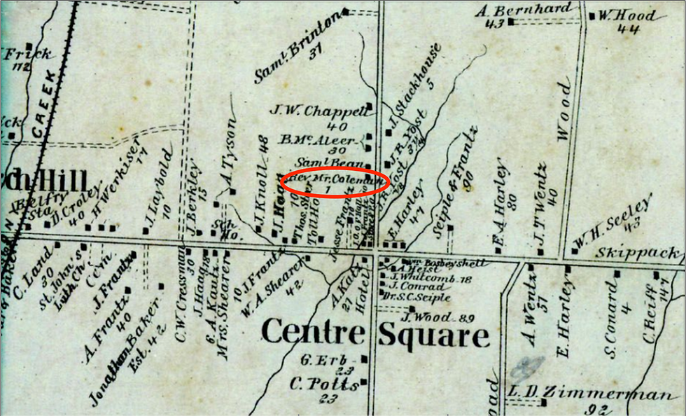
The Stony Creek Railroad was completed in 1874, making it the first railroad built in Whitpain Township. It was a "subsidiary" road that connects to the North Pennsylvania Railroad and extends from Norristown to Lansdale. Some time after the railroad was built the Belfry station was constructed.
Sad Fact #1: On September 21, 1919, a head-end collision between a freight train, a milk train and a passenger train, occurred near Belfry, injuring five passengers and three employees.


History of the Lehigh Valley Transit Company
The development of passenger transport resulted in the establishment of the Lehigh Valley Traction Company that began in Philadelphia, also known as the Liberty Bell Line. In 1905, the Lehigh Valley Traction Company purchased and united all the local routes together, forming the Lehigh Valley Transit Company.
Fun Fact #2: The Liberty Bell Line was named after the Liberty Bell was transported from Philadelphia to the Zion's Reformed Church in Allentown when the British occupied the city in 1777.
In 1912, after acquiring the Quakertown Traction Company, the LVTC acquired the Montgomery Traction Company, establishing the Lansdale and Norristown route in the Liberty Bell Trolley Line.
"The intention was to connect to the recently constructed Philadelphia and Western Railway which was a high speed trolley line that ran from 69th Street in Upper Darby to Norristown. By connecting to the Philadelphia and Western, the Lehigh Valley Transit Company could more easily access downtown Philadelphia. The travel time from Allentown to Philadelphia via Chestnut Hill was approximately three hours. Connecting to the Philadelphia and Western reduced the travel time from Allentown to Philadelphia to one hour and 58 minutes. Trolleys could reach speeds of over 100 miles per hour, and speeds of 80 miles per hour were routine."
- The Waetzman Planning Group, "Liberty Bell Trail Feasibility Study"
Ever since the automobile became popular in the US, people began to spend less time taking the trolleys, resulting its end to the Liberty Bell Line, and the Lehigh Valley Transit Company, in 1951.
Fun Fact #3: Based on the 1916 map, The Liberty Bell Line went through the Main Street of Ambler, then through Bethlehem and Sumneytown Pikes.


The Rise of SEPTA in the Philly Suburbs
The Pennsylvania and the Reading Railroad companies began to decline financial, causing the city to take action to improve and support passenger operations within the city. In 1961, five metropolitan counties (Montgomery, Bucks, Chester, Delaware, and of course Philly) formed together to create the the Southeastern Pennsylvania Transportation Compact (SEPACT), later formed into the Southeastern Pennsylvania Transportation Authority (SEPTA) in 1964.
After World War II, the rise in suburbanization was possibly another reason why there were demands for improvement of the commuter rails in the city.
Fun Fact #3: Delaware County did not initially participate in SEPACT due to the exclusion of subsidies.
Today, Ambler, Penllyn, and Gwynedd Valley stations are all under the operations of SEPTA in the Lansdale/Doylestown Line since 1981.
Bibliography
Bean, Theodore Weber. History of Montgomery County, Pennsylvania, Volume 2. (Philadelphia: Everts & Peck, 1884): 854-855.
Herman, Andrew Mark. Along the Wissahickon Creek. (Charleston: Arcadia Publishing, 2004). 22.
Herman, Andrew Mark. Eastern Montgomery County Revisited. (Charleston: Arcadia Publishing, 2005). 79.
Hepp, John. "SEPTA." The Encyclopedia of Greater Philadelphia. Last modified 2014. https://philadelphiaencyclopedia.org/archive/septa/.
Historic American Buildings Survey, Creator. Ambler Railroad Station, Outbound Secondary Station, North side of Butler Avenue, east & west of Reading Railroad tracks, Ambler, Montgomery County, PA. Pennsylvania Montgomery County Ambler, 1994. Documentation Compiled After. Photograph. https://www.loc.gov/item/pa3262/.
"Lehigh Valley Transit Company." Free Library of Philadelphia. Accessed October 22, 2021. https://libwww.freelibrary.org/digital/search/?subcollection=14.
Philadelphia's Great North Route: North Pennsylvania Railroad, to Connect Philadelphia with North Pennsylvania,Western New York, The Lakes and Canada West. (Philadelphia: Brown's Steam Power Book, Card, and Job Printing Office, Ledger Buildings, 1853).
"Philadelphia History: Early Railroad Transportation." USHistory. Last modified July 4, 1995. https://www.ushistory.org/philadelphia/railroad.htm.
Smith, Robert F. "Lehigh Valley." The Encyclopedia of Greater Philadelphia. Last modified 2017. https://philadelphiaencyclopedia.org/archive/lehigh-valley/.
Smith, Sandy. "SEPTA 50: A Prehistory of our Much Beloved/Maligned Transit Agency." Philadelphia Magazine. Last modified June 10, 2014. https://www.phillymag.com/news/2014/06/10/septa-50th-anniversary-prehistory/.
"Stony Creek RR Stock Certificate." monsimer.net. Accessed October 22, 2021. http://monsimer.net/StonyStock.html.
Summary of Accident Investigation Reports, No. 1. (Washington: Government Printing Office, 1920): 46, 50-52.
Szilagyi, Mike and Andrew W. Maginnis. "A Brief History of the Lehigh Valley Transit Co. Liberty Bell Route in Whitpain Township, Montgomery Co., Penna. Whitman's High Speed Rail." Wissahickon Valley Historical Society. Accessed October 22, 2021. https://www.wvalleyhs.org/wp-content/uploads/2020/05/A-Brief-History-of-the-Liberty-Bell-trolley-Whitpains-High-Speed-Rail-2018-10-03.pdf.
The District Reports of Cases Decided in All the Judicial Districts of the State of Pennsylvania During the Year 1901, Volume X. (Philadelphia: Howard W. Page, 1901): 539.
The Waetzman Planning Group. "Liberty Bell Trail Feasibility Study." Montgomery County Planning Commission. Last modified August 2005. https://perkasieborough.org/wp-content/uploads/2016/05/Liberty-Bell-Feasibility-Study.pdf.
"Whitlock’s Whitpain." Wissahickon Valley Historical Society. Accessed September 15, 2021. https://www.wvalleyhs.org/whittocks-whitpain/.
Woodland, Dale W. "Reading Company: A railroad history." Trains. Last modified October 7, 2021. https://www.trains.com/ctr/railroads/fallen-flags/reading-company-a-railroad-history/.
#pahistory #ambler #whitpain #lowergwynedd #train #railroad #tracks #penllyn #gwyneddvalley #belfry #lehighcounty #lehighvalleytransitcompany #LVTC #libertybell #trolley #libertybellroute #NPRR #northpensylvania #philadelphiareading #lehighvalley #stonycreekrailroad #SEPTA #regionalrails #philadelphia #philly


header.all-comments